Land Surveying.Reality Capture.Built for Texas Projects.

Acquisition Due Diligence Design Entitlement Construction Progress Documentation Closeout Acquisition Due Diligence Design Entitlement Construction Progress Documentation Closeout
The Eagle Surveying team at the Denton office

Who We Are

Built for Demanding Projects. Structured for Accountability.

Eagle Surveying is a professional land surveying firm with a dedicated Reality Capture practice, headquartered in Denton, Texas, with a second office in Waco, serving projects statewide. Civil engineers design from our data. General contractors build from our staking. Owners, developers, and public agencies make decisions from our deliverables at every milestone, from site selection through final closeout. The projects we take on span large sites, demanding schedules, and work that has to hold up from design through construction.

Eagle brings together the rigorous fundamentals of professional land surveying and the expanding capabilities of Reality Capture. Our licensed surveying operation and dedicated Reality Capture department work under one roof, where professional judgment, survey control, advanced collection technology, and disciplined production workflows stay connected. Our field and office teams carry each assignment from record research and field collection through production, quality review, and delivery.

Long-term client relationships are the foundation of this firm. Clients return because the work is dependable, communication stays direct, and our team takes ownership of its role from the first conversation through completion.

Eagle has the depth to take on demanding assignments and the discipline to deliver.

Proven Experience

Experience you can measure.

Projects to date 35,000+ Completed Projects
Professional staff 50+ Team Members
Experience 10+ Years in Business
Licensure 3 Registered Professional Land Surveyors
Offices 2 Texas Offices
Surveying Services

One Surveying Partner Across the Project Lifecycle.

A land title survey shapes the transaction. Topographic data drives design. Platting establishes the legal framework. Construction staking transfers approved plans to the field. As-built documentation records what was completed.

Eagle keeps those phases connected. The records, control, calculations, and project history established early in the process carry forward as the work advances. Each deliverable supports the next decision, and one firm remains accountable for the surveying throughout the project.

01 Phase one

ALTA/NSPS and Topographic Survey

Commercial land survey for the Shops at Prestwick development in McKinney, Texas.
02 Phase two

Construction staking

Construction staking at the Shops at Prestwick development in McKinney, Texas.
03 Phase three

As-Built Survey

Completed Shops at Prestwick commercial development in McKinney, Texas.
One project, Shops at Prestwick, McKinney, Texas
All surveying services
ALTA/NSPS Land Title Survey Boundaries, easements, improvements, and title conditions for due diligence and financing. Category 1A Land Title Survey Texas-specific boundary and title documentation for real estate transactions. Category 1B Standard Land Survey Commonly known as a boundary survey, establishing or retracing legal boundaries. Topographic Survey Elevations, contours, drainage, structures, and visible utilities for design. Tree Survey Location and size data for existing trees supporting design and municipal requirements. Platting Services Preliminary plats, final plats, replats, and amending plats creating legal lots. Construction Staking Signed and sealed design plans translated into precise field layout. Form Board Survey Form location and elevation documented before concrete is placed. As-Built Survey Final locations and elevations of completed improvements for closeout. Easement Exhibits & Legal Descriptions Signed and sealed exhibits defining easement location, dimensions, and purpose. Elevation Certificate Building elevations relative to mapped flood-hazard data for permitting and insurance. Talk to a surveyor Not sure which survey you need? Tell us about your project and we’ll scope the right one.
Reality Capture

A Complete View, From Air to Ground.

Eagle operates a dedicated Reality Capture department that combines advanced aerial and ground-based technology with professional survey control. From large tracts of land to buildings, structures, and active construction sites, our team captures the information project teams need to understand existing conditions, coordinate work, document progress, and plan what comes next.

Every assignment is scoped around the decisions the data must support. That determines the collection method, required control, level of detail, file formats, and final deliverables. Survey-grade datasets are tied to established control and reviewed under Texas RPLS oversight. The result is data, imagery, models, and documentation that support real project decisions.

Dense, survey-controlled point clouds that capture bare-earth terrain beneath vegetation.

Explore this service →

Measurable orthomosaics, surface models, and contours from high-resolution aerial imagery.

Explore this service →

Dense, colorized point-cloud measurements of buildings, structures, facilities, and other visible conditions.

Explore this service →

Time-stamped 360° imagery for walkthroughs and coordination, distinct from survey-grade measurement.

Explore this service →

Radiometric thermal capture delivered to your experts. Eagle does not diagnose conditions.

Explore this service →

Recurring capture creates a time-stamped record from preconstruction through closeout.

Explore this service →

Survey-controlled surfaces for earthwork quantities, inventory, and payment documentation.

Explore this service →

From capture to CAD

See What the Data Becomes.

Follow one Eagle dataset from the aerial capture through the orthomosaic, classified point cloud, bare-earth terrain model, contours, and final CAD-ready surface.

Buc-ee's Amarillo colorized elevation model with the aerial capture positions ringing the site perimeter
CAPTURE POSITIONS
True orthomosaic of the Buc-ee's Amarillo site
ORTHOMOSAIC
Classified ground-class LiDAR point cloud of the Buc-ee's Amarillo site with the store and canopies removed
CLASSIFIED POINT CLOUD
Bare-earth terrain model of the Buc-ee's Amarillo site with the structures cut out
BARE-EARTH TERRAIN MODEL
Elevation model of the Buc-ee's Amarillo site with labelled contours from 3585 to 3630 feet
CONTOURS
Topographic CAD survey of Buc-ee's in Amarillo, Texas, showing buildings, parking, contours, elevations, and site features.
CAD-READY SURFACE
Buc-ee's Amarillo · one Eagle dataset, source imagery to CAD-ready surface

NDAA Compliant | Blue UAS Approved

Cleared Platforms for Projects With Higher Requirements.

Some projects require more than standard aerial collection. Eagle fields qualifying aircraft and sensor configurations that are NDAA compliant and Blue UAS approved, supporting assignments with elevated procurement, security, and site-access requirements.

Flight operations are conducted under FAA Part 107 by pilots holding FAA Remote Pilot Certificates.

Multiple Platform Options

A range of aircraft allows the collection plan to be matched to site size, sensor needs, endurance, and operating conditions. NDAA compliance and Blue UAS approval apply to qualifying airframe and sensor configurations, not to every platform in the fleet.

Mission Planning & Site Coordination

Airspace, access, owner protocols, required documentation, and data-handling expectations are addressed before mobilization.

Survey Integration

When measurement is part of the scope, aerial collection remains connected to Eagle’s survey control, production workflow, and professional review.

White drone in flight in front of the Denton County Courthouse clock tower
Industries We Serve

Experience Across the Markets Shaping Texas.

From data centers and industrial facilities to public infrastructure, campuses, energy, and large-scale development, each market brings its own schedule, access, coordination, and documentation demands.

Colorized LiDAR of a data center site, Hubbard
Data Centers & Mission-Critical Facilities Secure collection, dependable control, and recurring documentation for fast-moving campuses from due diligence through closeout. Data Center, Hubbard, TX
Eagle Surveying truck and robotic total station at a Walmart distribution center
Industrial, Manufacturing & Logistics Survey and site data supporting phased construction, facility expansion, material movement, and active operations. Walmart Distribution Center
Shops at Prestwick retail storefronts with black awnings in McKinney, Texas.
Commercial & Retail Development Consistent surveying across individual sites and multi-location programs, from acquisition and entitlement through construction. Shops at Prestwick, McKinney, TX
Aerial LiDAR mapping of a bridge crossing near Crawford, Texas
Municipal & Public Infrastructure Clear, defensible information for roadways, drainage, utilities, parks, airports, and public capital programs. Crawford, TX
Corsicana ISD campus construction
Education & Higher-Ed Campuses Campus documentation and construction support planned around occupied facilities, safety, scheduling, and procurement requirements. Corsicana High School, Corsicana, TX
Multifamily community with Eagle field unit on site, Arlington
Multi-Family & Master-Planned Communities Control, platting, staking, and documentation carried across phases, lots, amenities, and long buildout schedules. Viridian Apartments, Arlington, TX
Robotic total station with transmission lines and solar infrastructure
Energy, Solar, BESS & Transmission Terrain, corridor, easement, layout, and as-built information for energy sites and linear infrastructure. Krum, TX
Robotic total station on the floor of AT\&T Stadium
Specialized High-Visibility Venues Flexible survey and capture strategies for stadiums, resorts, events, aviation, and one-of-a-kind venues with unusual access or coordination demands. AT&T Stadium, Arlington, TX
Why clients choose Eagle

Big-project capability.Clear accountability.

Coordinated by Eagle Eagle coordinates the fieldwork, Reality Capture, production, and quality review behind each assignment and remains responsible for the final deliverable.
Professional Survey Control When measurement is part of the scope, survey control and RPLS review are built into the workflow from the start.
Deliverables in Your Format CAD, GIS, point clouds, imagery, models, and other project-ready formats are matched to the needs of the assignment.
Deadlines That Hold Clear communication, committed schedules, and ownership from kickoff through final delivery.
Dedicated Reality Capture Fleet Aerial LiDAR, eVTOL and multirotor aircraft, terrestrial laser scanning, 360° capture, thermal imaging, and advanced collection technology.
Advanced Field Technology GNSS rovers, robotic total stations, RTK network coverage, aerial systems, and terrestrial scanning support work throughout Texas.
Scalable Capacity Resources can expand with project size, volume, and schedule while Eagle maintains consistent standards, oversight, and quality control.
Statewide Coverage Teams based in Denton and Waco support assignments throughout Texas, with mobilization based on project scope and schedule.
Eagle field technician in a high-visibility vest at a McKinney project site

Fieldwork that keeps the project moving.

What Clients Say

What project teams say about working with Eagle.

03 / 04

“With more than 20 years in the land development industry, I’ve worked with many surveying firms, and Eagle Surveying stands out as one of the best. Their team is consistently professional, responsive, and fairly priced. Their attention to detail, clear communication, and commitment to delivering quality work make them a pleasure to work with.”

David Greer, P.E. Associate Vice President, Pape-Dawson

“Eagle Surveying has been a go-to on numerous projects, and they are consistently excellent. Their team is responsive, easy to communicate with, and always available when needed. Their reliability and attention to detail give me full confidence when starting a development project with their topo.”

Carson Hardwick Civil Engineer

“Eagle Surveying has been a valued participant in building the Mar-Properties Business Park developments in Denton. Eagle has been very good at setting priorities and completing the job consistent with construction schedules. Never an issue with the work, and the price is right.”

JR Marriott Developer

“We’ve used Eagle for projects all over Denton and the North Metroplex, and have been really happy with their responsiveness, communication, and deliverables. Great company to work with!”

Jason Abt General Contractor

“Over the years, Dan and his staff at Eagle have proven themselves time and again as trustworthy project partners. Their work is accurate and their service is efficient and thorough.”

Andrew Cousins Landscape Architect

“Great people who do great work. Eagle has provided great and fast services for various civil projects across North Texas.”

Edgar Molina Civil Engineer, Pape-Dawson

“We always have positive experiences with Eagle Surveying. Having a trustworthy and professional team like theirs can make all the difference, and they do a fantastic job providing excellent customer service.”

David Lopez Developer

“The level of service at Eagle Surveying is stellar, the response time is fast, and the entire team is dedicated to following through with questions on any project. Eagle is our go-to surveying company.”

Trace Arnold Developer

“As an engineer, Dan and the rest of the team at Eagle have been fantastic. They are responsive and very good at handling those last-minute city comments that always seem to pop up.”

Ian Norfolk Civil Engineer

“Our go-to surveyor at Abstract Construction. They always go above and beyond and understand customer service.”

Leif Barnes Contractor

“Dan, Alesha, Mason, and the rest of the Eagle Survey team have been fast, reliable, responsive, accurate, and cost competitive. We have found no one that can meet the expectations set by the Eagle Survey Team.”

William Milligan Civil Engineer

“We work with Eagle Surveying consistently and they never disappoint. Dan and his team are top-notch and extremely knowledgeable. The turnaround is quick and the quality of work is pristine.”

Cole Frazier Commercial Realtor
Client reviews as published on Google.
Project Experience

Work on the ground and above it.

View All Projects →
Buc-ee’s
Pass Christian, Mississippi

Buc-ee’s

Aerial Photogrammetry · 360° Site Documentation & Virtual Walkthroughs

Eagle Surveying’s Reality Capture team provided high-accuracy orthomosaics and detailed 2D and 3D site models, tied to state-plane coordinates and supported by DroneDeploy-based 360° site documentation for review and coordination.

View project →
H-E-B Market & Fuel Station
Melissa, Texas

H-E-B Market & Fuel Station

Construction Staking

Construction Staking included layout of canopy and kiosk footings, paving, tank holes, car-wash features, light poles, and fuel-station equipment.

View project →
Fixed-wing mapping aircraft in flight above the wooded Cedar Hill project site.
Cedar Hill, Texas

Cedar Hill Commercial Development

Aerial Photogrammetry · Topographic Survey · Construction Staking

Eagle Surveying provided Aerial Photogrammetry and orthomosaic mapping across a 410-acre commercial development, along with Topographic Survey and Construction Staking services supporting site planning and construction.

View project →
Amazon distribution facility and surrounding site during construction in Robinson, Texas.
Robinson, Texas

Amazon Distribution Center

Topographic Survey

Eagle Surveying completed a Topographic Survey across more than 43 acres of undeveloped land, documenting terrain, drainage features, and existing site conditions for design and construction planning.

View project →
Eagle surveyor with GNSS equipment on an upper floor of a high-rise construction project.
Dallas, Texas

Dallas High Rise

Construction Staking

Eagle Surveying transferred building grid lines from lower levels to the 15th floor, holding vertical accuracy through the structure.

View project →
Dallas Data Center
Dallas, Texas

Dallas Data Center

Terrestrial Laser Scanning (TLS) · Aerial Photogrammetry

Eagle Surveying documented plate elevations using Terrestrial Laser Scanning tied to the project’s survey control, supported by aerial orthomosaic documentation and direct client access through DroneDeploy.

View project →
Pool shells and site improvements under construction at the WorldSprings development.
The Colony, Texas

WorldSprings

Construction Staking

Eagle Surveying provided layout and vertical control for structures, utilities, and grading across the resort site.

View project →
Eagle Surveying truck and total station beside a Shops at Prestwick retail storefront.
McKinney, Texas

Shops at Prestwick

ALTA/NSPS Land Title Survey · Platting · Construction Staking

Eagle Surveying provided full-scope surveying from due diligence through construction on a retail development.

View project →
Completed Dutch Bros roasting facility and surrounding site.
Melissa, Texas

Dutch Bros Roasting Facility

Platting · ALTA/NSPS Land Title Survey · As-Built Survey

Eagle Surveying carried platting, title, and topographic work through construction staking and as-built closeout.

View project →
Dollar General Market storefront, parking area and surrounding site.
China Spring (Waco), Texas

Dollar General Market

ALTA/NSPS Land Title Survey · Tree Survey · Platting

Eagle Surveying supported due diligence, municipal permitting, and final platting for a new market site near Waco.

View project →
Colorized three-dimensional surface with elevation bands and measurement outlines.
Heath, Texas

Commercial Retail Center

Stockpile Analysis · Volumetric Analysis

Eagle Surveying used aerial capture and surface modeling to calculate material volumes for inventory planning.

View project →
Aerial view of the Benchmark Metal Services project.
Ponder, Texas

Benchmark Metal Services

Terrestrial Laser Scanning (TLS)

Eagle Surveying documented interior and exterior existing conditions to support planned office buildouts and a future facility expansion.

View project →
03 / 12

Eagle Cares

Built here. Committed here.

Our people show up for the organizations strengthening North and Central Texas communities.

Explore Eagle Cares →
Eagle Surveying team with Toys for Tots donation boxes beside an Eagle truck.
Eagle Surveying team members with collected school supplies for Cumberland Youth & Family Services.
Start a project

Have a large or technically demanding project?

Tell us about the site, project stage, schedule, and required deliverables. Our team will help determine the appropriate surveying and Reality Capture approach.

Contact Us

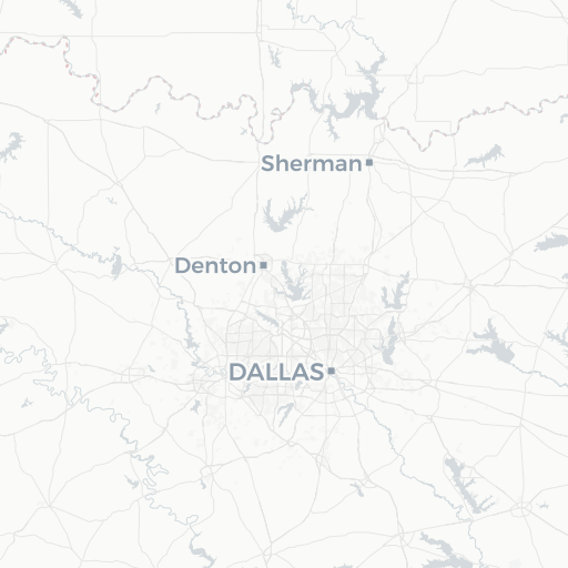
Serving all of Texas.

North Texas Denton Headquarters 212 W. Sycamore St., Denton, TX 76201 940-222-3009
Central Texas Waco Office 8225 Central Park Dr., Suite 300, Waco, TX 76712 254-481-0306
Denton
Waco
Leaflet © OpenStreetMap © CARTO